Sleeping Bear Dunes National Lakeshore is a internationally famous park and draws visitors from all over the world. The park has thirty five miles of Lake Michigan shoreline, including North and South Manitou Islands. Besides the Sleeping Bear Dunes, there are other dunes and bluffs located throughout the park. Forests, lakes, and rivers complete the park’s inventory. The park and adjacent areas get a lot of visitors during the peak summer months. The huge park encompasses 71,187 acres, so there is plenty of room for everyone.
Highway M22 runs through the length of the park and, along with highway M109, provides access to the park’s features. There is private property throughout the park. There are two villages in the park: Empire and Glen Arbor. Cities and villages that are close to the park are Elberta, Frankfort, Benzonia, Beulah, Honor, Maple City, Cedar, and Leland.
I kayaked some of the area’s lakes and rivers during the summer season while on a family vacation with my wife, Colleen, and our son, Trevor. Colleen and Trevor are very understanding when it comes to my passion for kayaking, so I was able to get away occasionally to paddle the scenic waterways of the park. I will give you detailed information and maps of the waters that I visited. I hope that you enjoy paddling them as much as I did!
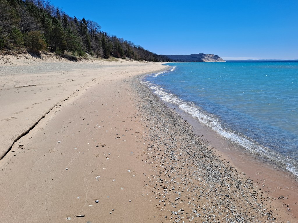
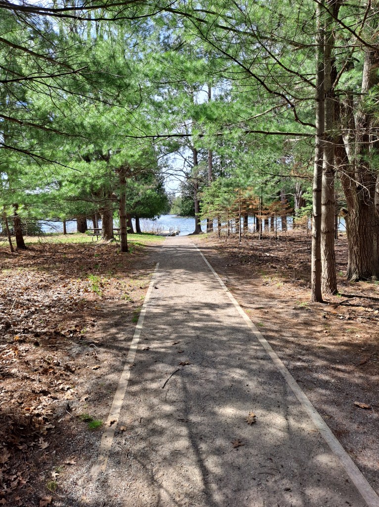
The park Visitor Center is located in the village of Empire. It’s a treasure trove of information and is a good place to start your trip. The friendly park rangers are more than happy to answer any questions that you may have. A park pass purchased at the Visitor Center will give you access to all areas of the park. You are now ready to kayak!
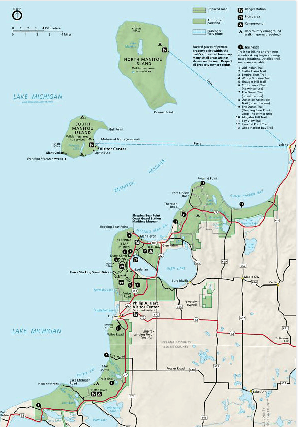
LAKE MICHIGAN, EMPIRE BLUFFS
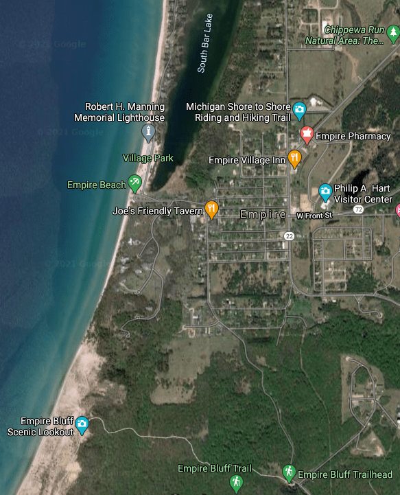
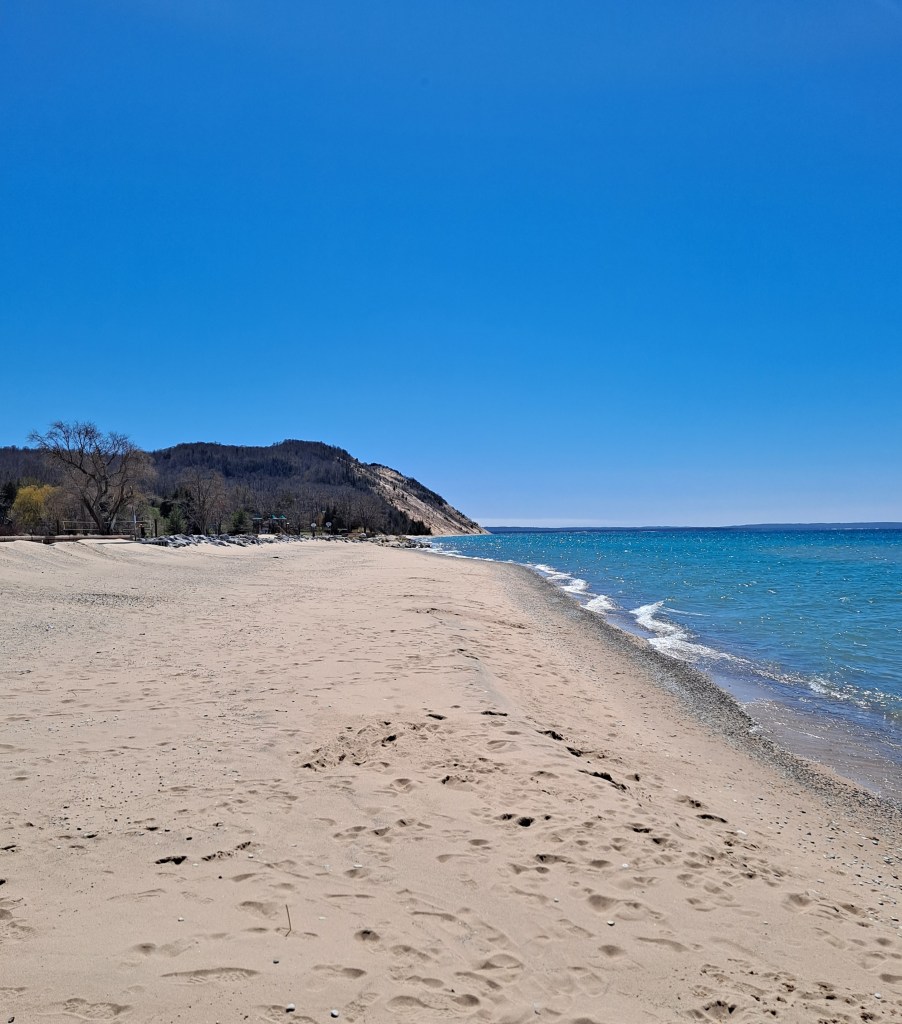
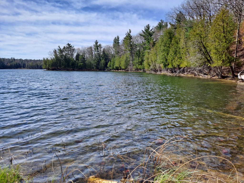
When you think of Sleeping Bear Dunes, your thoughts probably gravitate towards the tall, steep sand bluffs that face the waters of Lake Michigan. Kayaking the Lake Michigan shoreline at the base of these bluffs is an unforgettable experience and the coastline at the Empire Bluffs is a perfect choice.
The drawback to kayaking Lake Michigan’s remote shoreline at the bluffs of Sleeping Bear Dunes is the long distance from the nearest lake access. If a storm comes up suddenly and you are paddling many miles from the nearest boat landing, your safety would be compromised. No kayaking adventure is worth your life! There are two lake access sites close to Empire Bluffs, making it the obvious choice.
When kayaking Lake Michigan or any of the other great lakes, get a reliable near-shore marine forecast before you leave. Believe the forecast. If the forecast calls for bad weather, don’t go anyway because the sky “looks good”. Conditions can change rapidly on the big lakes. I can illustrate this fact with a short story. We were fishing in the channel between the piers at a port on southern Lake Michigan. The wind was calm and the seas were running one to two feet. We spotted ominous black clouds on the horizon and they were approaching quickly. We immediately retreated to our car. Within twenty minutes of sighting the storm, the wind was howling and the waves were washing over the piers! I’m not exaggerating. You can imagine what it would be like in a kayak if such a storm came up in a matter of minutes. Don’t tempt fate when kayaking the big lakes! Don’t become a statistic!
Enough about safety. Let’s go kayaking! There is Lake Michigan access in the village of Empire, at the public beach. The beach also has access to South Bar Lake. I didn’t paddle South Bar Lake, but it looked like a interesting lake to explore. Empire Bluffs are south of the beach.
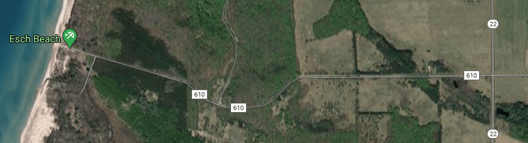
I wanted a little longer trip, so I accessed the lake south of the Empire Bluffs, at the Esch Road Beach. Head west on Esch Road, also called CR610, from highway M22, south of the village of Empire. The beach is at the end of the road. If you don’t have four wheel drive, don’t park in loose sand. It’s a good way to get stuck. This applies to anywhere in the park.
To some kayakers, launching a kayak in Lake Michigan can be a challenge. If you’ve never launched a kayak in surf, then you are in for a surprise. Waves frequently wash over your kayak when they break and sometimes you will get a considerable amount of water in your boat. You can’t paddle your kayak with a bunch of water sloshing around in it. Go back to shore, dump the water out, and try again. I got lucky and made it on my second try! This is an instance where a spray skirt would come in handy. Unfortunately, I didn’t have one. Another strategy is getting in your kayak beyond the surf, in deeper water. That’s not easy, but it is an option. Don’t be discouraged. Once you are successfully in your kayak and paddling, you’ll forget all about it.
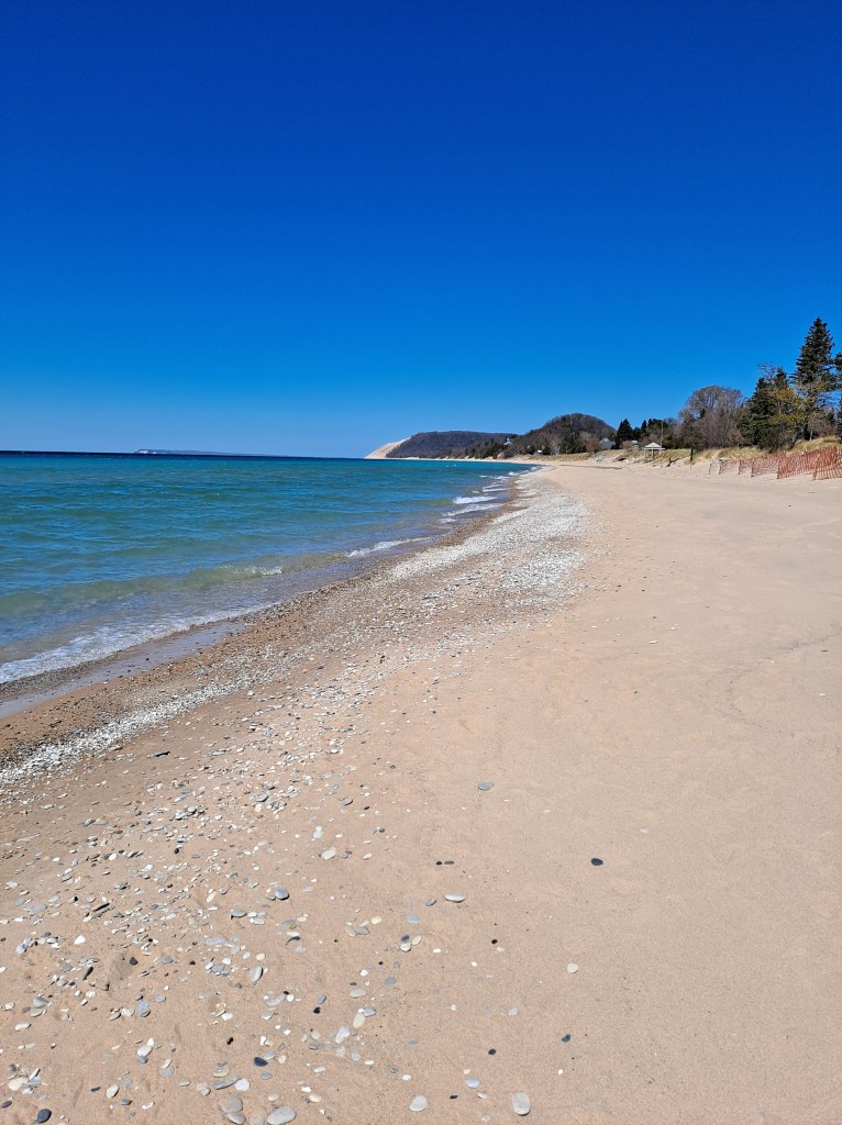
My experience paddling Empire Bluffs was fantastic! Sun, cloudless sky, and light winds were the order of the day. Seas were one to two feet with light surf close to shore. As you head toward the bluffs, keep your kayak out from shore, beyond the breakers. Paddling swells is much easier and safer than negotiating breaking waves. While I paddled the bluffs, the swells increased in height from two feet to four feet. The increase in the size of the swells did not make paddling more difficult. With a little experience, you’ll be able to match the rhythm of your paddling to the rhythm of the waves.
Paddling the coastline below the towering Empire Bluffs is a unique experience. You can fully appreciate their size and beauty from a boat. To the north, unless it’s hazy or foggy, you can see the Sleeping Bear Bluffs off in the distance. To the south, Platte River Point juts out into the lake. You cannot replicate this scenery anywhere else! Enjoy!
PLATTE RIVER, HIGHWAY M22 TO LAKE MICHIGAN
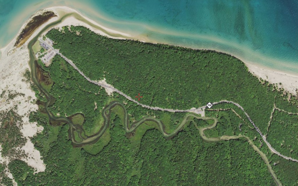
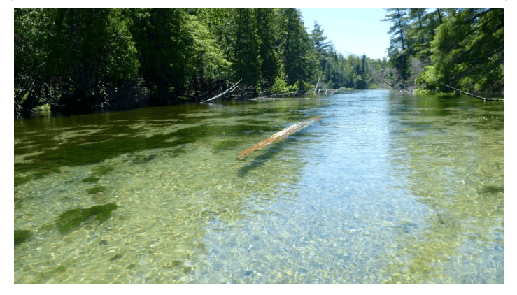
This stretch of the Platte River is a relatively short trip, but it is a worthwhile destination. The river is shallow, crystal clear, and has a mostly sand bottom with some sections of gravel and rock. The current is moderate. It is suitable for kayakers of all skill levels. The banks of the river are wooded and they transition to low dunes close to Lake Michigan. Lake Michigan Road, also known as CR708, runs roughly parallel to the river from highway M22 to the boat landing and a parking area at Lake Michigan. The road is located on the north side of the river.
This stretch of the Platte River can be crowded with boaters and tubers during the peak months of the summer season. To avoid the crowds, go early in the morning. Before Memorial Day and after Labor Day are other viable options.
There is a canoe/kayak livery at the M22 bridge over the river. If you rent a watercraft from the livery, you can use their launch site.
There is a public access site on Lake Michigan Road (CR708). The entrance is 350 feet northwest of M22.
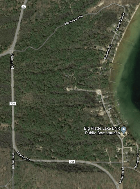
For a little longer trip, there is access at the northwest corner of Big Platte Lake. Head south on Platte Road (CR706) from M22. At the end of the second curve in the road, take Arborvitae Drive north to the MDNR boat launch. The river flows out of Platte Lake at the north end of the lake.
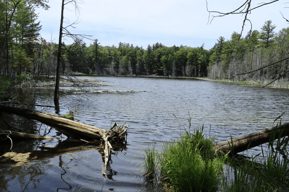
From M22, the river flows in a relatively straight line. At the first major bend in the river, there is a creek that connects to Mud Lake. Sometimes, the creek is navigable. It might be blocked by fallen trees. I’ve paddled it and it’s worth checking out.
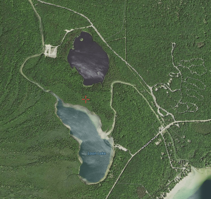
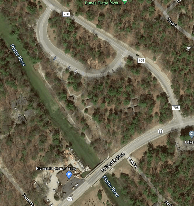
In this satellite photo, Mud Lake is north of Loon Lake. The cleared area west of Mud Lake is the weir area. Big Platte Lake is in the lower right corner of the photo. Lake Michigan Drive (CR708) is northwest of the river and northwest of Mud Lake. M22 is also known as North Scenic Highway.
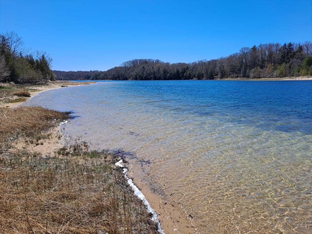
Downstream from the creek to Mud Lake, the Platte flows into the middle of the east side of Loon Lake. The lake is surrounded by national lakeshore parkland. There is a boat ramp on the lake. The entrance to this access site is on M22, a quarter mile south of the M22 bridge over the river. Loon Lake is deep with a near shore drop-off all the way around the lake. The river flows out of the lake at its north corner.
Downstream from Loon Lake, there is a trout and salmon weir across the river with a gate in the middle for paddlers. The gate is open most of the year. At certain times, in the fall season, the gate is closed and the weir must be portaged.
Next to the CR708 sign on the map is the El Dorado Landing. This spot is popular as a launch site for people who travel the river in tubes.
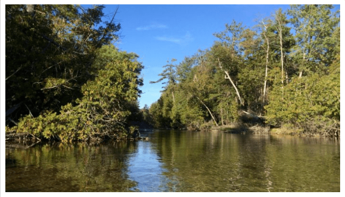
The river twists and turns as it meanders toward Lake Michigan. There are some shallow spots at the lower end of the river. The river flows into Lake Michigan’s Platte Bay at Platte River Point.
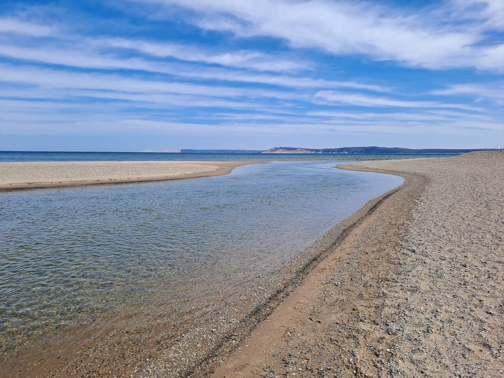
The boat landing and the parking area are just upstream from the mouth of the Platte. You can paddle out into Lake Michigan from the river if conditions are safe. The mouth of the river is a nice spot for a extended stay. The Sleeping Bear Bluffs and the Empire Bluffs are easily visible. I have been known to wade upstream from the landing with a sit-up air mattress, enjoying a cold beer while drifting back down the river to Lake Michigan! I’m sure you’ll have fun on this scenic stretch of the Platte River!
NORTH BAR LAKE
North Bar Lake lies just north of the village of Empire. The long, narrow lake was once part of a bay on Lake Michigan. The lake was formed when water ponded behind a sand bar. The sand bar is now a long, narrow, wooded piece of land that separates North Bar Lake from Lake Michigan. At the northwest end of the lake, there are low sand dunes with a channel leading to Lake Michigan. Whether or not the channel actually connects to the Big Lake depends on water levels.
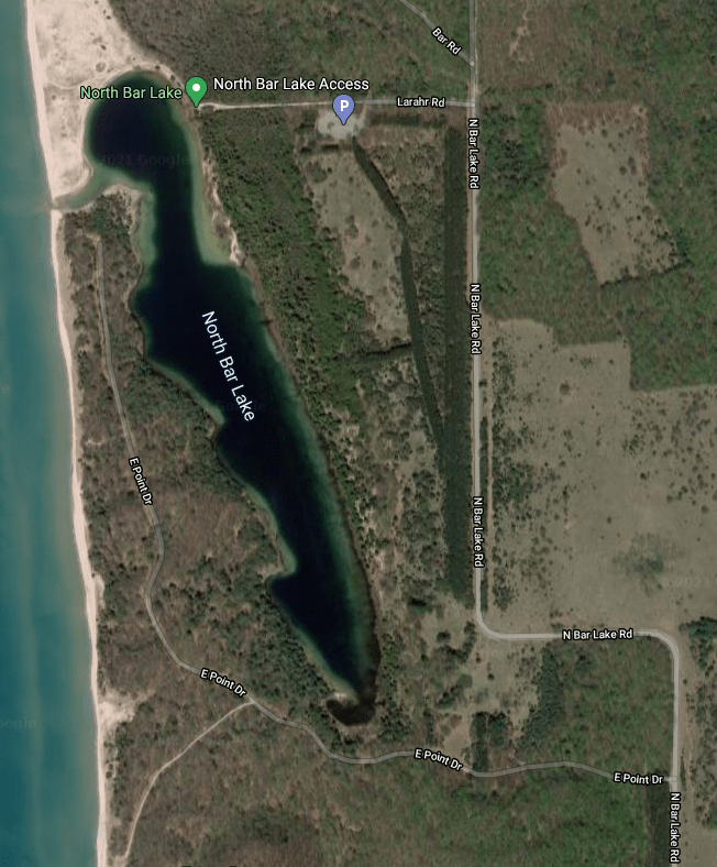
From highway M22, north of Empire, head west on Voice Road. Turn north on North Bar Lake Road. This road curves west, then curves back north. Next, go west on Larahr Road. It will take you to a paved parking lot with a vault toilet.
A footpath at the northwest corner of the parking lot leads to the lake and the boat access. The footpath continues around the north end of the lake to the Lake Michigan beach. The trail to the lake is five hundred feet long and not very many people are willing to carry a boat that far. I originally balked at the long carry, but quitting is for sissies.
When I arrived at the lake with my boat, I took a quick swim to cool off and began my voyage. I paddled around the north end of the lake. The shifting sand dunes along this shore have created a steep drop-off right at the water’s edge. I continued south along the west shore and turned into the shallow channel to Lake Michigan. This was a year of low water levels, so the channel ended just shy of Lake Michigan. It’s a very short portage to the Big Lake.
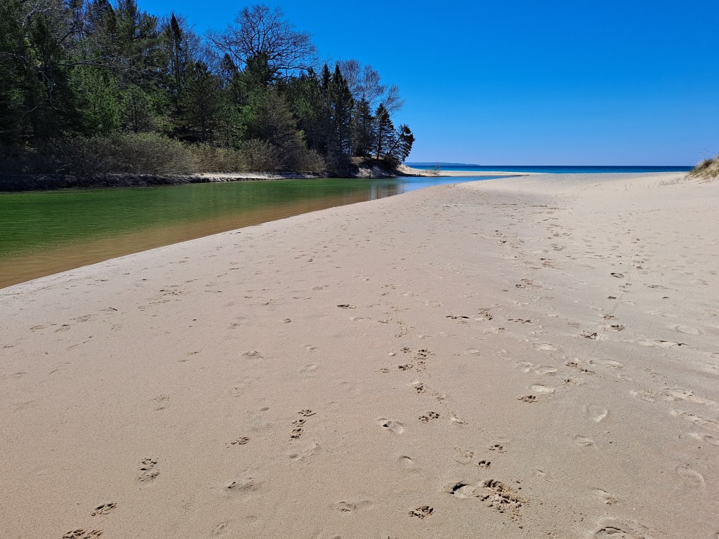
I didn’t make the portage, choosing to spend my time on North Bar Lake instead. I did beach my kayak at the end of the channel and walked the few dozen steps to the shoreline of Lake Michigan to check out the scenery. To the north, the bluffs of the Sleeping Bear Dunes rise up from the water’s edge. To the south, the Empire Bluffs are equally impressive. What a cool spot!
I returned to my kayak and paddled the channel back to North Bar Lake, heading south along the west side of the lake.
The rest of the lakeshore is different than the low dunes at the north end of the lake. The coastline is wooded and pleasing to the eye. There is a series of points on the west side of the lake, south of the Lake Michigan channel. On the east side of the lake, I noticed many tiny streams flowing into the lake and I could hear the sound of running water coming from the woods. There must be many springs along this shore.
This lake is beautiful and I lingered on the water for quite a while. I was not looking forward to the long carry back to the parking lot. My kayak was not going to carry itself. On the way back, the trail seemed twice as long. Even though I complain about the carry, I still enjoyed every minute of this adventure. The extra effort it took to get to and from the lake was worth it! North Bar Lake is off the beaten path and is a gem in the Sleeping Bear Dunes National Lakeshore. I hope you have a chance to paddle its waters!
When you return to the corner of Larahr Road and North Bar Lake Road, instead of heading south on North Bar Lake Road, turn north on Shauger Hill Road.

This scenic seasonal road meanders up and over Shauger Hill. It emerges from the woods at highway M109, 700 feet south of the entrance to Pierce-Stocking Scenic Drive, the highlight of the park.
CRYSTAL RIVER, FISHER ROAD TO GLEN ARBOR
The Crystal River begins as the outlet from Little Fisher Lake in Leelanau County. Little Fisher Lake is connected to Fisher Lake and Glen Lake. The river flows in a series of U-shaped loops to Sleeping Bear Bay in Lake Michigan. The Crystal River is shallow and the water is exceptionally clear. The current is slow to moderate and the bottom is mostly sand with some gravel and rock. The banks of the river are wooded. There are two portages with a optional third portage. Kayakers of all skill levels will enjoy this river.
Colleen and Trevor joined me on this Crystal River adventure. I had my own kayak and we rented kayaks for Colleen and Trevor from an outfitter in the village of Glen Arbor. The outfitter provided transportation for us and our kayaks to the launch site.
When you begin paddling, keep an eye on the water depth. In some places, the river may be too shallow to float you and your kayak. You will have to wade your boat to deeper water.
We began our four and a half mile trip at a boat landing on Fisher Lake Road, south of Crystal View Road (CR675). The landing is on the north side of the river, on the west side of the road. Shortly after launching, we encountered our first portage at a small dam. The portage was short and easy.

Below the dam, we paddled through several of the U-shaped loops and arrived at Crystal View Road (CR675). The river flows under the road through three culverts. I recommend taking the far left culvert. The trip through the culvert is a short, fast, downhill run and the river makes a hard left turn as soon as you exit the culvert. Running the big pipe was great fun and we made it through without incident. If you are less adventurous, there is the optional portage on the left bank of the river with easy river access on the other side of the road.
After the culverts, the river heads north through another series of U-shaped loops and ends up back at Crystal View Road (CR675). This is the last portage of the trip.
Downstream from the Crystal View Road portage, the river travels in a relatively straight line southwest for six tenths of a mile. It then makes a one hundred eighty degree turn back northeast. We ended our trip just downstream from the bend, on the north side of the river, at our outfitter’s boat landing in Glen Arbor.
Our trip down the scenic Crystal River was a memorable one and we hope to do it again soon!
DEER, BASS, and OTTER LAKES
These three lakes are nestled back in the forest, west of highway M22, between the village of Empire and the Platte River. They can be accessed by heading west on Trails End Road from M22. Each lake is fairly deep with a near shore drop-off. Otter Creek flows north from Deer Lake to Bass Lake, then north from Bass Lake to Otter Lake, and, finally, northwest from Otter Lake to Lake Michigan. Trails End Road crosses over Otter Creek between Bass and Otter Lakes. I don’t think the lakes are very well known. I paddled the lakes during summer and my kayak was the only boat on the lakes. Due to the small size of the lakes, you can easily navigate them in an afternoon, without hurrying.
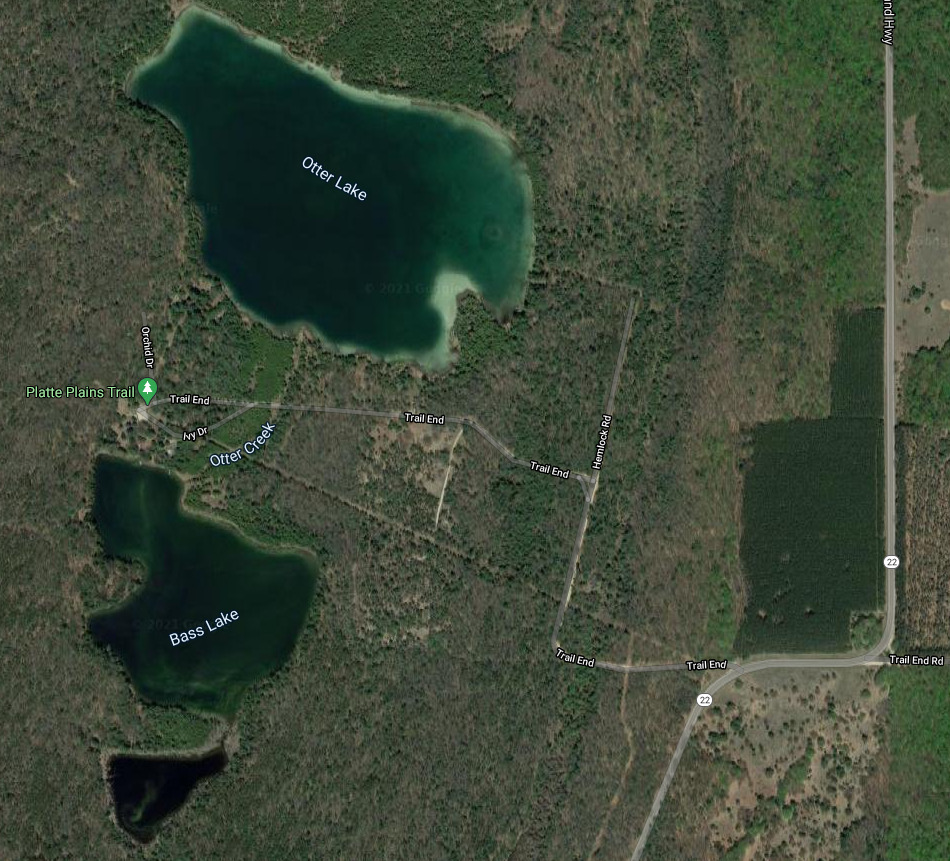
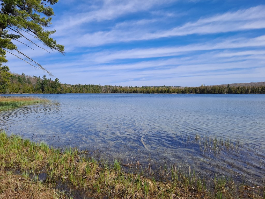
Otter Lake is the largest and the northern-most of the three lakes. Otter creek flows north from Bass Lake to the south shore of Otter Lake. The creek is not navigable between the two lakes. Otter Creek exits the north side of Otter Lake and it is not navigable there either. The entrance to the lake access is on the north side of Trails End Road, three hundred feet east of Otter Creek. The shoreline is muddy. There are about five private residences on the lake, but I’ve never seen any signs of activity.
When I was paddling along the north shore of the lake, I spotted small animals swimming toward me from the center of the lake. Our courses were going to intersect, so I stopped paddling and sat perfectly still. When they got closer, I could see that they were a family of otters! They stopped about fifteen feet away from my kayak, looked at me, and voiced their displeasure at my presence. The otters soon got tired of me, swam to shore, and disappeared into a cedar swamp. It was an experience that I’ll never forget!
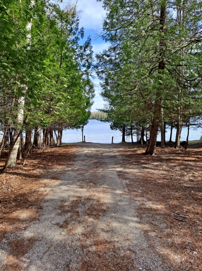
Bass Lake lies between Otter Lake and Deer Lake. The lake can be accessed from a parking lot at the end of Trails End Road. It’s a short carry from the lot to the water’s edge. There is a nice dock at the launch site. The site is another one of my legendary swimming holes. The waters of Bass Lake are very clear and the forested shores are picture perfect.
Deer Lake is the smallest and the southern-most of the three lakes. Deer Lake can only be accessed from Bass Lake. Unfortunately, that access is difficult. Otter Creek flows one hundred sixty feet from Deer Lake to Bass Lake and it is blocked by a beaver dam. The shoreline of the creek and the area around the dam is swampy and has fallen trees scattered about. The shoreline around the lake has been flooded by the beavers and is lined with dead trees. I could not find a decent place to portage.
Deer Lake is scenic and beautiful, but you have to be extremely determined to kayak it.
If you visit the Sleeping Bear Dunes National Lakeshore, be sure to include Deer, Bass, and Otter Lakes in your kayaking itinerary. These scenic lakes are sure to please!
