WATT ROAD TO FAWN RIVER KAYAK
The headwaters of the Fawn River is in Steuben County, Indiana. The Fawn River flows into the St. Joseph River in Constantine, Michigan. The city that is closest to this trip is Sturgis, Michigan. The river is fifty five miles long.
Fawn River Kayak provided shuttle service for me and my kayak. They have a large inventory of rental kayaks. I was impressed by their customer service and I enjoyed doing business with them.
My trip took place on a weekday in early October of 2025 during a long spell of dry weather. The river level was extremely low. By viewing the exposed riverbed, I could tell that the river was at least a foot lower than normal flow. Some sections of the Fawn were difficult to paddle due to the shallow water. I recommend kayaking the river during normal water levels.
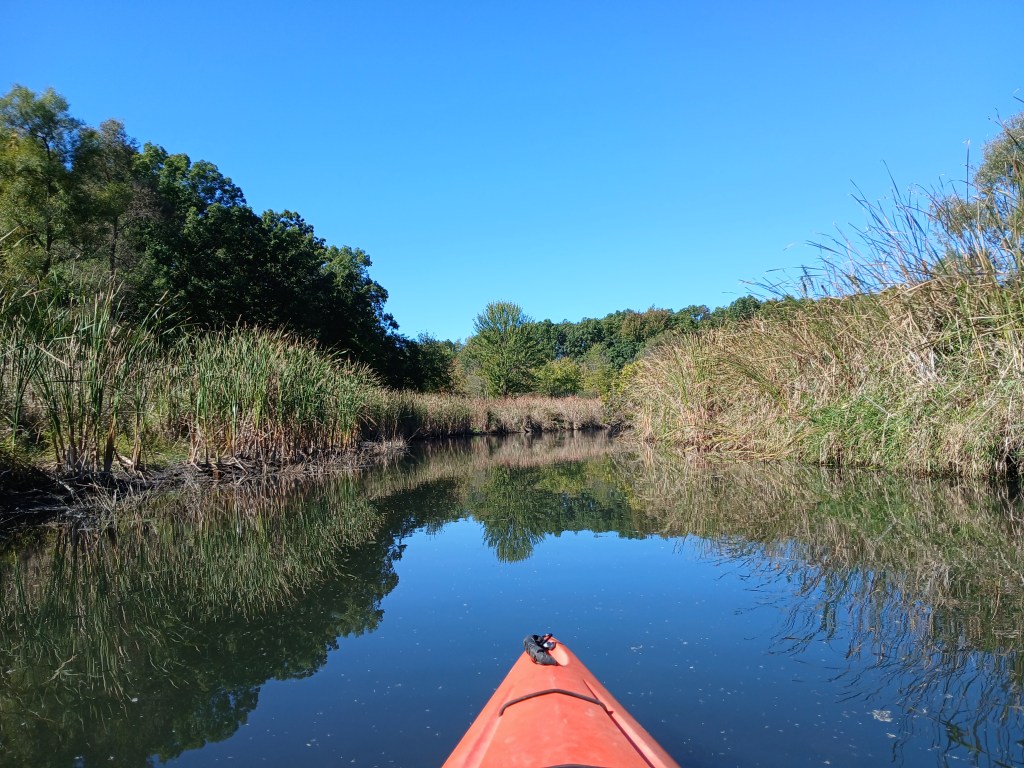
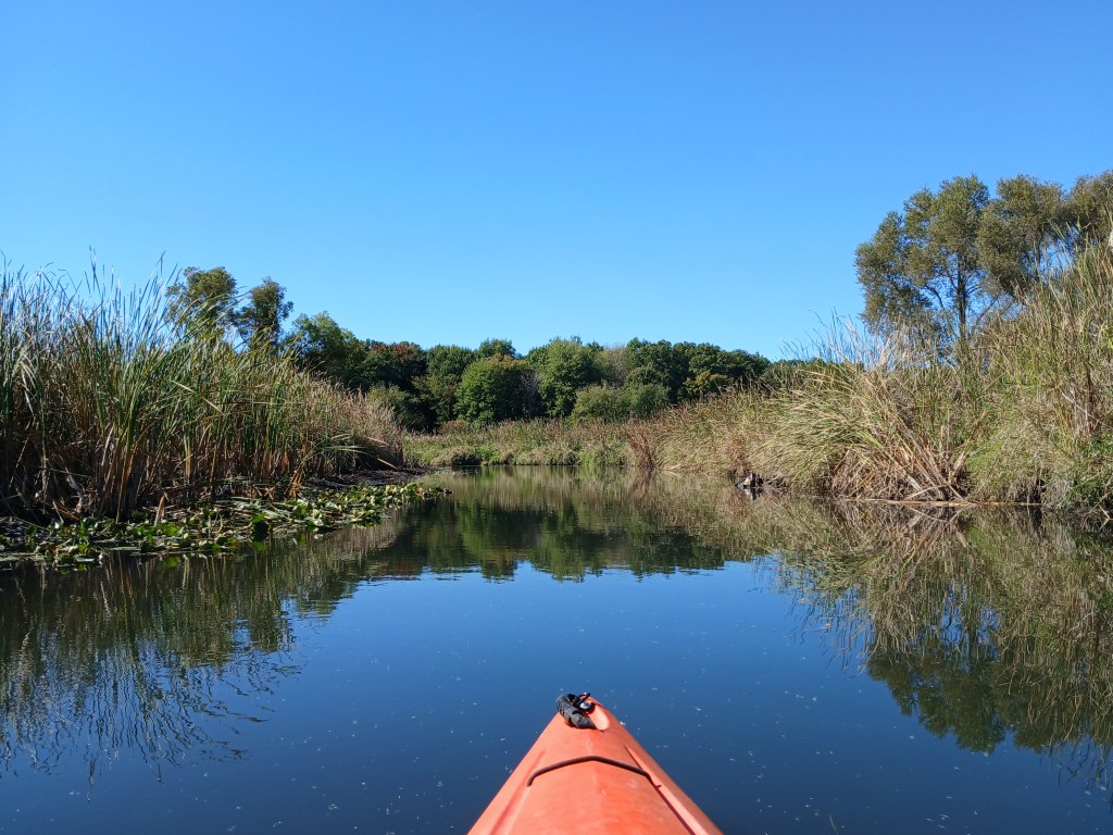
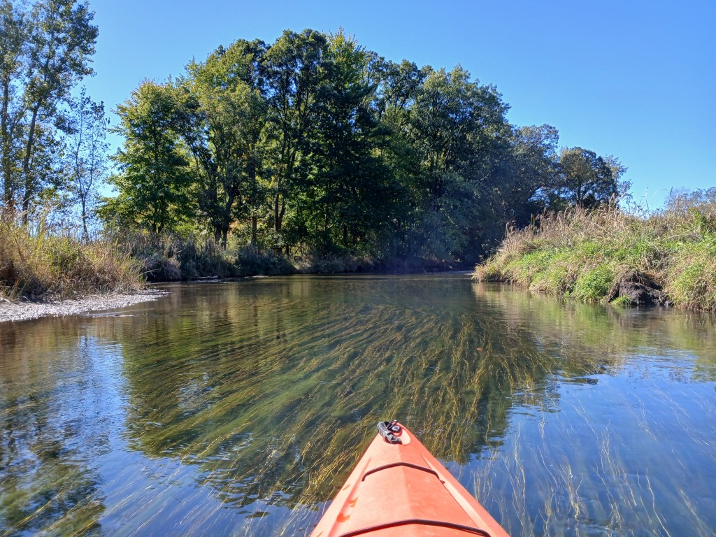
On the day of my trip, the water was very clear. Most of the river was between twenty and forty feet wide. Water depth ranged from four feet deep to less than a foot deep. The riverbank was lined with cattails and tall grasses with some lily pads.
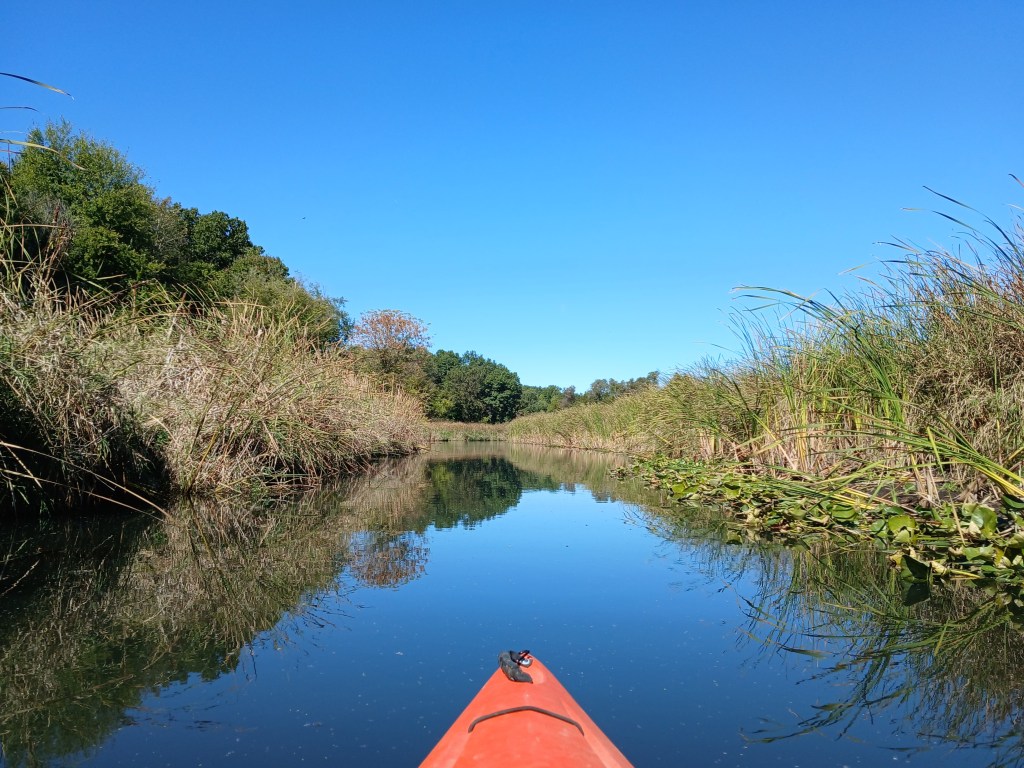
Because of the tall vegetation, I couldn’t see much beyond the riverbank. As near as I could tell, the land was flat agricultural interspersed with wooded areas. Fawn River Kayak keeps the river clear of all garbage.
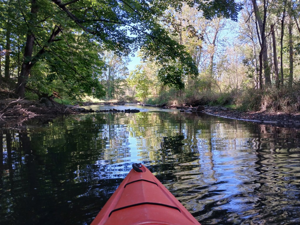
This portion of the Fawn River seemed to be in three sections. The first section was rocky. The middle section flows through the lake bed of a long-gone mill pond. The dam that created the mill pond was either washed out or removed years ago. The river reverted back to it’s original channel. I’m guessing that the rocks in this section are covered up with sediment that accumulated behind the dam. The bottom of the middle section is now mostly sand and gravel. The final section, downstream from the dam site, is rocky with some sand and gravel. The water is a little deeper than the first rocky section.
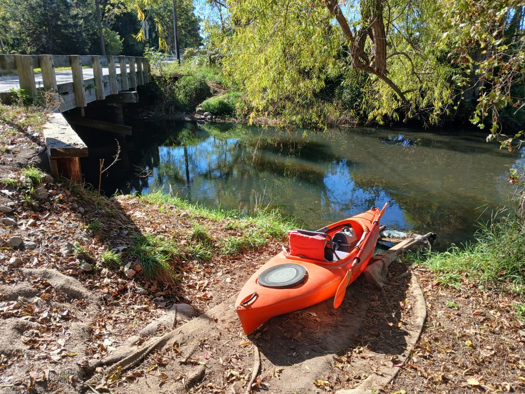
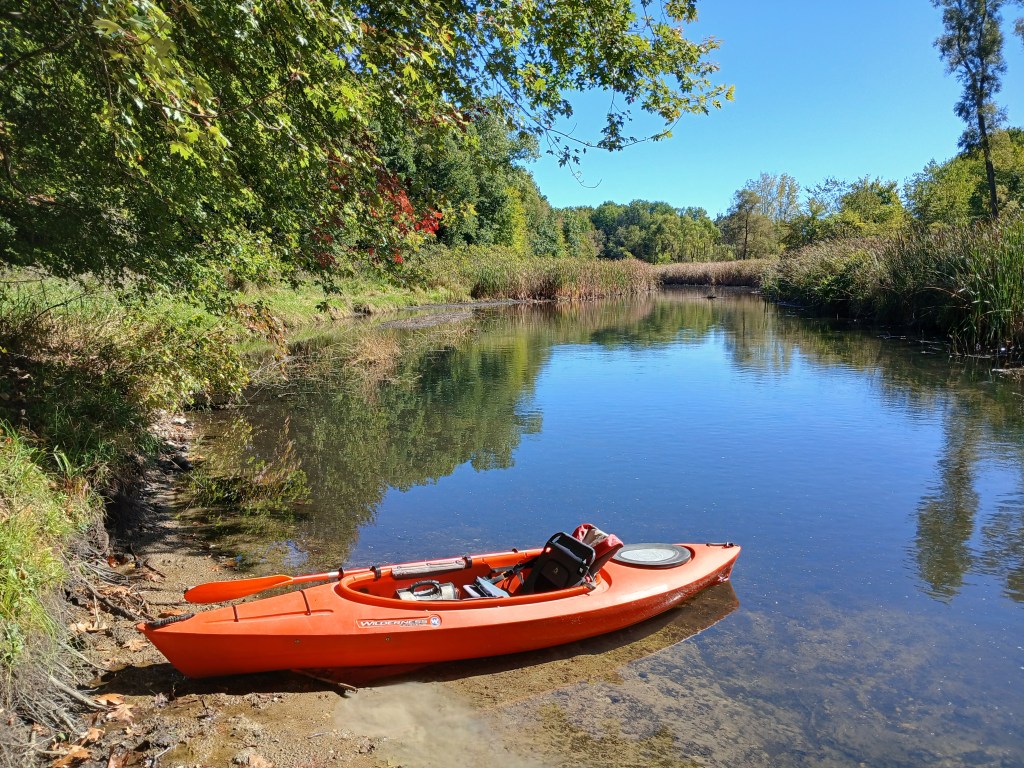
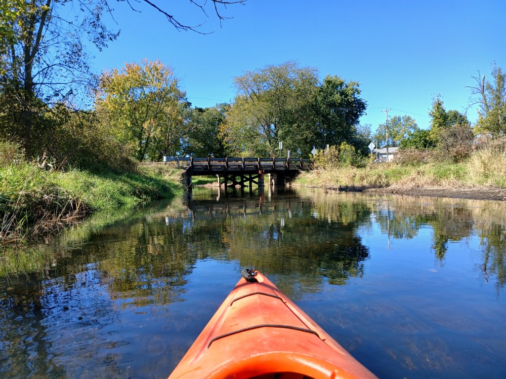
My trip began at the Watt Road bridge. A convenient boat slide made launching my kayak easy. I didn’t see any boats or people during my trip. Fawn River Kayak clears paths through fallen trees that block passage.
I didn’t take any photos of the first rocky section of the river. I was too busy dodging rocks and avoiding shallow water. I ran aground quite a few times, but I was always able to get through by using my paddle as a push pole. I don’t like to abuse my paddle, but it was the only way. In hindsight, I should have gotten out of my kayak and dragged it over the rocks.
The middle section is smooth sailing, but keep an eye out for shallow water.
There are only a few places to get out of your kayak for a break. If you happen upon a likely spot, take advantage of it.
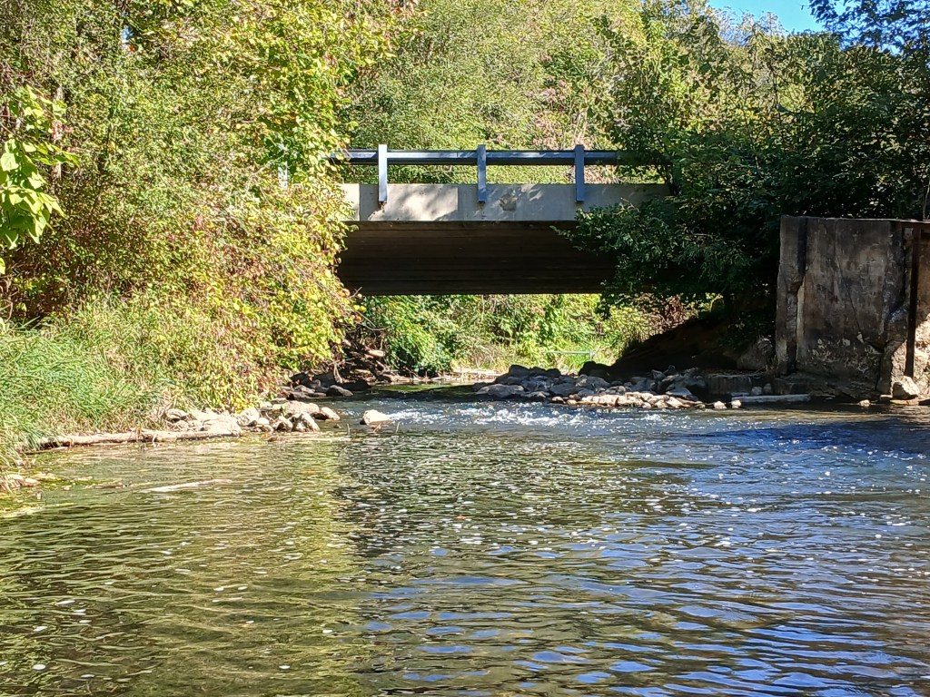
The first bridge down river from the Watt Road bridge is a Fawn River Road bridge. The dam was located at the bridge. Remnants of the structure are still visible. There is a small rapids at the bridge.
Downstream from the dam site, the river bottom turns rocky. I found that the rocks and shallow water were easy to navigate in this section of the river.
Next up is the Carls Road bridge.
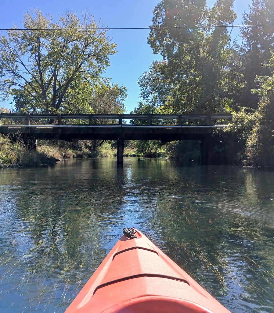
Continuing on down the river, a Fawn River Road bridge spans the river for a second time.
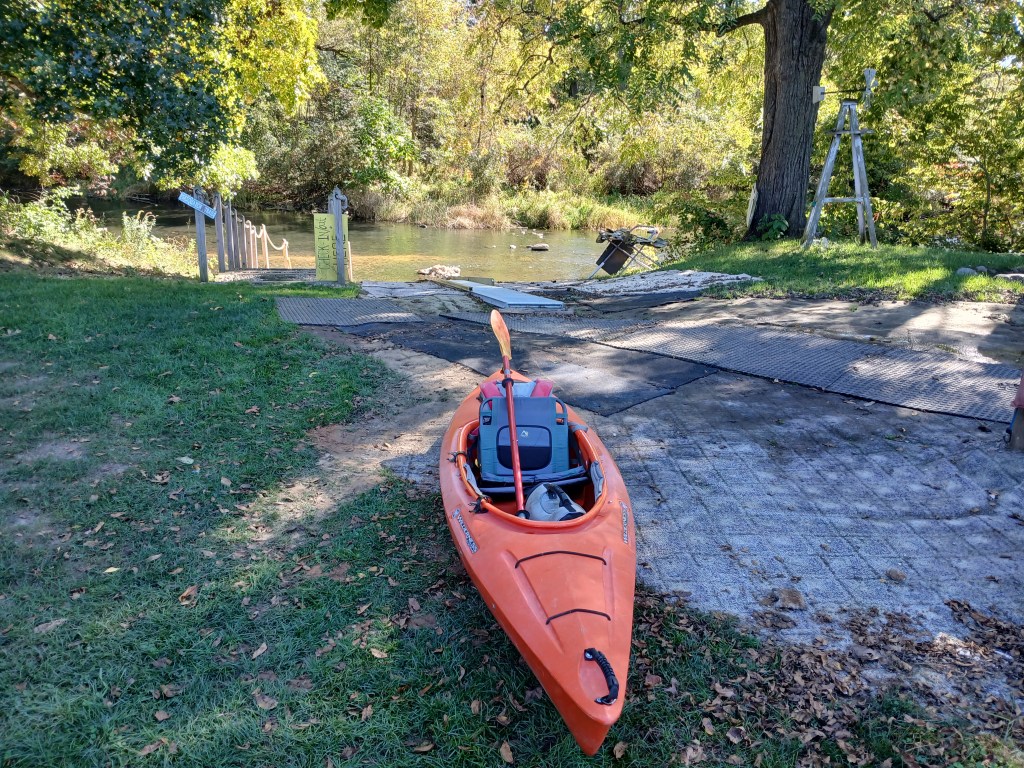
Around a couple of bends, the boat landing for Fawn River Kayak is on the right (north) side of the river, marking the end of this trip. Steps and a water slide with rollers leads to the top of a hill and the parking area.
Fawn River Kayak offers another trip, beginning at their boat landing and ending at the Big Hill Road bridge. I’ll be taking that trip next spring.
